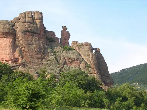
Belogradchik Rocks
Red sandstone towers up to 200 metres tall, with a fortress built straight into them.
- Mountain
- Stara Planina
- Elevation
- 800 m
- Time
- 2-4 hours
- Difficulty
- Easy
- Coordinates
- 43.63330, 22.68330
About this place
These are not mountains so much as sculpture. Two hundred million years of erosion has left a field of red and ochre sandstone towers running for some thirty kilometres, the tallest around 200 metres. Each formation has a name and a folk story attached — the Madonna, the Horseman, the Schoolgirl, the Monks — and the stories are usually about someone being turned to stone for a transgression.
The Kaleto fortress is the reason to come rather than just look. The Romans built the first walls here in the first century, using the rock towers themselves as natural ramparts, and the Bulgarians and Ottomans each extended it. You can climb through three courtyards to the top, and the final section is a steep stair cut into the rock with a serious drop beside it.
The town below is small and quiet, and the Magura Cave with its prehistoric bat-guano paintings is half an hour away. This is the far north-west, a long way from Sofia and largely ignored by foreign visitors, which is much of its appeal.
When to go
At its best in April, May, June, September and October.
May to October on the main ridge. The Kom to Emine traverse, roughly 600 km, takes most people 20 to 25 days and is usually walked from late June. Winter on the high central section is a serious undertaking with full winter equipment.
Getting there
The range runs some 550 km, so there is no single entrance. Kalofer and Karlovo serve the Botev massif and are on the Sofia to Burgas railway. Etropole and Teteven open the western section, Kotel and Sliven the east.
Water
Variable and the main planning problem on the traverse. Long sections of the ridge are dry, particularly in the east in late summer. Plan hut to hut and carry more than feels necessary.
What to watch out for
- The north face of Botev is steep and holds snow late. The summit carries a weather station and its own microclimate, and the wind there is frequently the strongest in the country.
- Fog on the open ridge, where marking can be sparse between huts and there is little to navigate by.
Weather at this elevation
Weather at this elevation
Reading the forecast