Skip to content
Bulgarian Hiking Club

Where to go first

The places worth the journey, with what each one actually asks of you and when it is at its best. Sorted by season, because half of these are wrong in the wrong month.

How busy each one gets

A crowding signal, not a visitor count. Derived from how heavily each site appears in Bulgarian trip reporting and operator itineraries.

  • The Seven Rila Lakes100
  • Rila Monastery95
  • Musala88
  • Cherni Vrah and the stone rivers82
  • Vihren76
  • Belogradchik Rocks71
  • Trigrad Gorge and Devil's Throat68
  • Raysko Praskalo and Botev54
01

The Seven Rila Lakes
The Seven Rila Lakes
Anthony Ganev · CC BY 3.0 · Wikimedia Commons

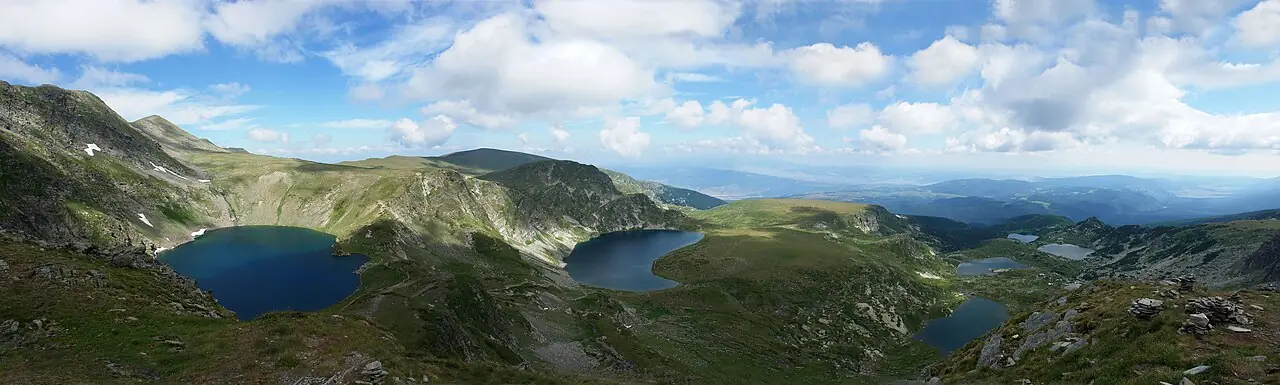
Seven glacial lakes stacked up a cirque, and the most photographed landscape in the country.

Range
Rila
Elevation
2500 m
Time
3-5 hours
Grade
Easy

Best in

  • Jan
  • Feb
  • Mar
  • Apr
  • May
  • Jun
  • Jul
  • Aug
  • Sept
  • Oct
  • Nov
  • Dec

The lakes sit between 2,100 and 2,500 metres, each one named for its shape: the Tear for its clarity, the Eye for being the deepest cirque lake in Bulgaria at 37.5 metres, the Kidney, the Twin, the Trefoil, the Fish Lake and the Lower Lake. They drain one into the next down the cirque, which is why the circuit reads as a single staircase of water rather than seven separate places.

A chairlift from Pionerska removes about an hour of climbing and drops you near the Rila Lakes hut. From there the standard circuit runs up past the lower lakes to the viewpoint above the Tear, which is where every photograph you have seen was taken, then loops back down. It is not a difficult walk, but it is a high one, and the weather at 2,500 metres is not the weather at the car park.

This is also the most crowded place in the Bulgarian mountains. On a July or August weekend the path to the viewpoint can queue. The lakes are a sacred site for the Universal White Brotherhood, who gather here each August for the paneurhythmy — worth knowing if you arrive on the 19th and find several thousand people in white circling the Kidney.

Local tip

Go on a weekday, or start at first light. By ten o'clock in August the chairlift queue alone can cost you an hour.
Show on map
02

Rila Monastery

Rila Monastery
Pudelek (Marcin Szala) · CC BY-SA 3.0 · Wikimedia Commons

A UNESCO World Heritage site, and the spiritual centre of the country for a thousand years.

Range
Rila
Elevation
1147 m
Time
2-3 hours
Grade
Easy

Best in

  • Jan
  • Feb
  • Mar
  • Apr
  • May
  • Jun
  • Jul
  • Aug
  • Sept
  • Oct
  • Nov
  • Dec

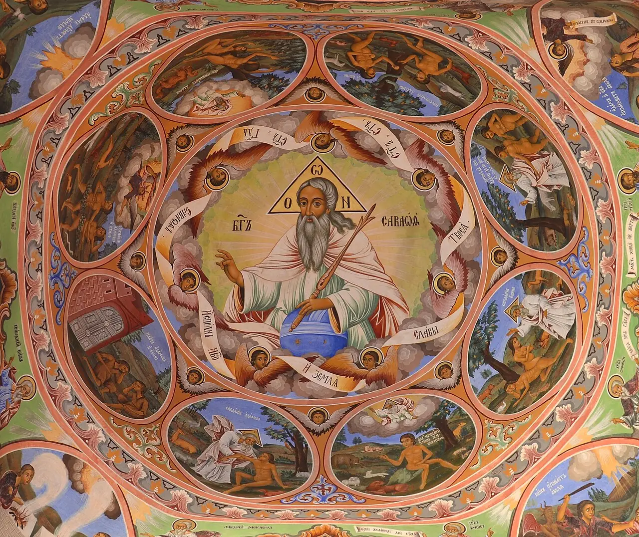
Founded in the 10th century around the cell of Ivan Rilski, the country's patron saint, the monastery survived Ottoman rule, fire and the twentieth century largely intact. What you see today is mostly the 1830s rebuild, and it is extraordinary: black and white striped arcades stacked four storeys around a courtyard, with the Hrelyo Tower of 1335 surviving from the medieval complex at its centre.

The frescoes in the main church were painted in the 1840s, some by Zahari Zograf, and they are worth more time than most visitors give them. The museum holds Rafail's Cross, a wooden crucifix carved with around 140 biblical scenes and more than 600 figures — the monk who made it worked for twelve years and went blind finishing it.

It sits at 1,147 metres in a forested valley, and it pairs naturally with a walk. The path up to Saint Ivan's cave and grave, where he lived as a hermit, takes about an hour each way and takes you out of the crowds almost immediately.

Local tip

Dress modestly — shoulders and knees covered — or you will not get into the church. Arrive before ten or after four to avoid the coach parties.

Show on map
03

Musala

Musala
Ysmiv4ica · CC BY-SA 3.0 · Wikimedia Commons

The highest point in the Balkans, and higher than anything in Greece outside Olympus.

Range
Rila
Elevation
2925 m
Time
5-6 hours
Grade
Moderate

Best in

  • Jan
  • Feb
  • Mar
  • Apr
  • May
  • Jun
  • Jul
  • Aug
  • Sept
  • Oct
  • Nov
  • Dec

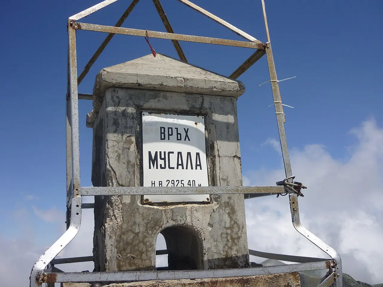
At 2,925 metres Musala is the roof of the peninsula. The name comes through Ottoman Turkish from Arabic and is usually read as 'close to God', which the summit earns on a clear day: the view runs to Pirin, the Rhodopes and, in exceptional visibility, to Mount Olympus itself.

The standard route starts from the Yastrebets gondola above Borovets, which lifts you to 2,369 metres and removes most of the ascent. From there the path climbs past the Musalenski lakes and the Everest hut to a final rocky pull onto the summit, where a weather station has stood since 1932. In good July conditions it is a straightforward walk that a fit beginner can do.

It is not always good conditions. Musala generates its own weather, cloud can seal the summit within minutes, and the north-facing gullies hold snow into July — every year somebody underestimates them. The last gondola down is the other constraint; check it before you commit, because the walk out to Borovets on tired legs adds a long two hours.

Local tip

Start from the first gondola. Afternoon storms build over Rila most summer days and the summit ridge is no place to meet one.

Show on map
04

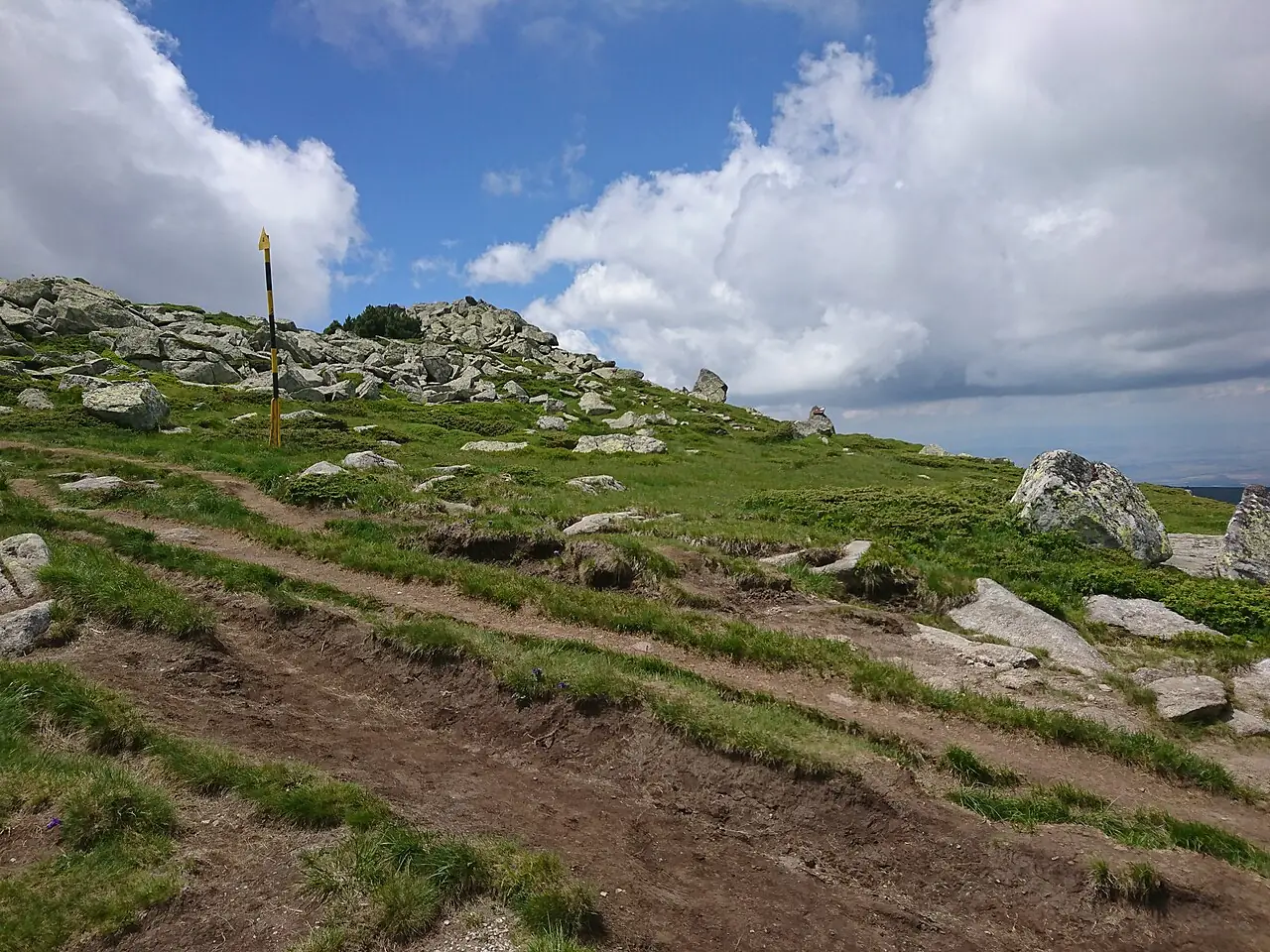
Cherni Vrah and the stone rivers

Cherni Vrah and the stone rivers
Иван · CC BY-SA 4.0 · Wikimedia Commons

A 2,290-metre summit you can reach by city bus, above unique periglacial boulder fields.

Range
Vitosha
Elevation
2290 m
Time
2-3 hours
Grade
Easy

Best in

  • Jan
  • Feb
  • Mar
  • Apr
  • May
  • Jun
  • Jul
  • Aug
  • Sept
  • Oct
  • Nov
  • Dec

Vitosha became the first nature park in the Balkans in 1934, and its greatest oddity is the stone rivers — moreni, ribbons of granite boulders running hundreds of metres down the slopes, formed by freeze-thaw cycles at the edge of the last ice age. Fields like these exist in very few places on earth, and the largest here, at Zlatnite Mostove, is a kilometre and a half long.

Cherni Vrah itself is reachable in a couple of hours from Aleko, which city buses and a gondola serve directly from Sofia. You can leave a desk in the centre and be on a 2,290-metre summit inside two hours without a car, which is close to unique among European capitals.

That accessibility is exactly why it catches people out. The summit plateau is featureless in cloud, the descent gullies all look alike, and Mountain Rescue is called out here more than the mountain's modest height suggests. In winter the wind chill on top is a genuine alpine problem, forty minutes from a tram stop.

Local tip

Do not walk on the stone rivers. The boulders shift, the gaps are deep, and a broken leg in there is a difficult rescue.

Show on map
05

Vihren

Vihren
Pudelek (Marcin Szala) · CC BY-SA 3.0 · Wikimedia Commons

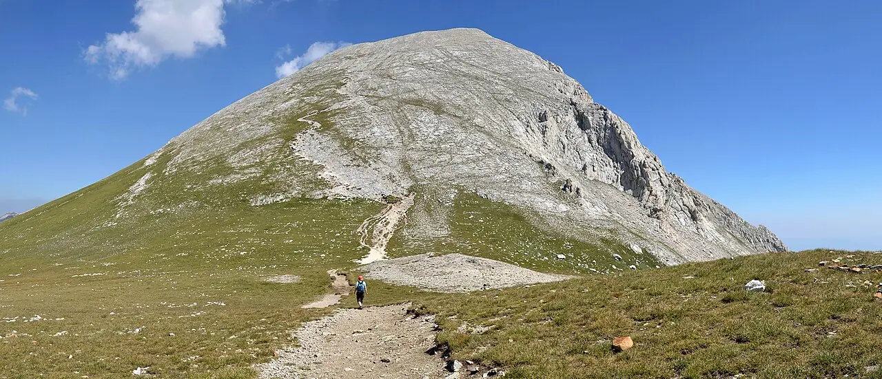
Marble, and the most serious mainstream summit in Bulgaria.

Range
Pirin
Elevation
2914 m
Time
5-6 hours
Grade
Hard

Best in

  • Jan
  • Feb
  • Mar
  • Apr
  • May
  • Jun
  • Jul
  • Aug
  • Sept
  • Oct
  • Nov
  • Dec

Vihren is eleven metres lower than Musala and a considerably bigger day. The mountain is marble, which changes everything: it is bright, sharp-edged, and genuinely slippery when wet, so a light shower can raise the grade of the descent rather than just make it unpleasant.

Most people start from Vihren hut at 1,950 metres, reached by a rough road up from Bansko. The standard summer route climbs steadily through the Kazana cirque before the final rocky section. The northern approach is a different and harder proposition and should not be confused with it — people do confuse them.

The reason to come is what sits next to it. Koncheto, the knife-edge ridge linking Kutelo to Banski Suhodol, is a metre wide in places with a fixed cable and a fatal drop on both sides. It appears on casual route lists as though it were a walk. It is not, it has killed people, and it should never be anyone's first outing in Pirin.

Local tip

Check the forecast for rain specifically, not just storms. Dry marble is fine; wet marble is a different mountain.

Show on map
06

Belogradchik Rocks

Belogradchik Rocks
The original uploader was TodorBozhinov at English Wikipedia · CC BY-SA 1.0 · Wikimedia Commons

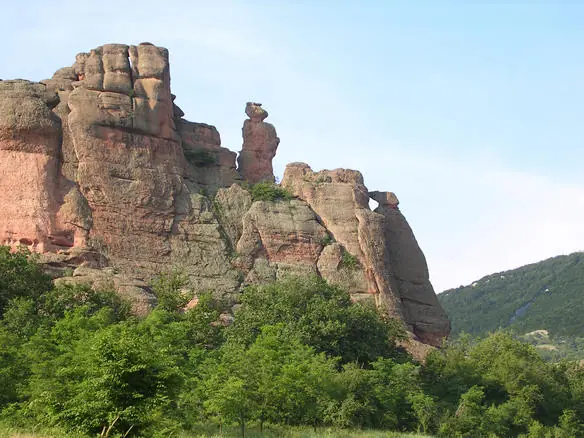
Red sandstone towers up to 200 metres tall, with a fortress built straight into them.

Elevation
800 m
Time
2-4 hours
Grade
Easy

Best in

  • Jan
  • Feb
  • Mar
  • Apr
  • May
  • Jun
  • Jul
  • Aug
  • Sept
  • Oct
  • Nov
  • Dec

These are not mountains so much as sculpture. Two hundred million years of erosion has left a field of red and ochre sandstone towers running for some thirty kilometres, the tallest around 200 metres. Each formation has a name and a folk story attached — the Madonna, the Horseman, the Schoolgirl, the Monks — and the stories are usually about someone being turned to stone for a transgression.

The Kaleto fortress is the reason to come rather than just look. The Romans built the first walls here in the first century, using the rock towers themselves as natural ramparts, and the Bulgarians and Ottomans each extended it. You can climb through three courtyards to the top, and the final section is a steep stair cut into the rock with a serious drop beside it.

The town below is small and quiet, and the Magura Cave with its prehistoric bat-guano paintings is half an hour away. This is the far north-west, a long way from Sofia and largely ignored by foreign visitors, which is much of its appeal.

Local tip

Late afternoon light turns the sandstone genuinely red. Midday flattens it to grey-brown and wastes the trip.

Show on map
07

Trigrad Gorge and Devil's Throat

Trigrad Gorge and Devil's Throat
Nikola Gruev · CC BY-SA 3.0 · Wikimedia Commons

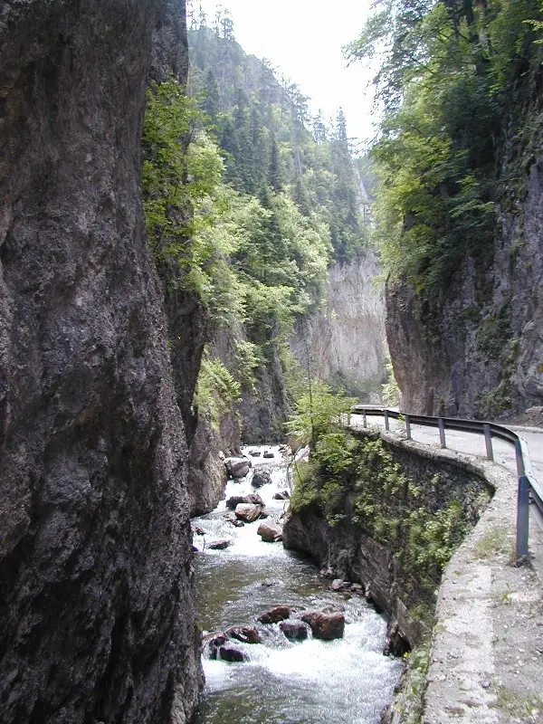
A river that disappears into the mountain, through vertical marble walls 300 metres high.

Elevation
1450 m
Time
2-3 hours
Grade
Easy

Best in

  • Jan
  • Feb
  • Mar
  • Apr
  • May
  • Jun
  • Jul
  • Aug
  • Sept
  • Oct
  • Nov
  • Dec

The Trigradska river cuts a gorge barely wide enough for the road, with walls rising 300 metres on either side, then vanishes entirely into a cave mouth. Inside the Devil's Throat it falls 42 metres into an underground chamber large enough to hold a cathedral, producing the noise that gives the place its name.

The strange part is what happens next. Nothing that goes into the siphon has ever come out. Dye tests and objects dropped in have never been recovered downstream, which is the origin of the local claim that this is where Orpheus descended into the underworld to find Eurydice — the whole Rhodope range is Orpheus country, and here the geography makes the myth feel almost reasonable.

You enter through a man-made tunnel and climb 301 steps back out beside the roaring water. The chamber is genuinely impressive and genuinely loud. Take a layer; it is cold and wet inside whatever the temperature outside.

Local tip

Combine it with the Buynovo gorge and the Eagle's Eye platform nearby. On its own the cave is under an hour.

Show on map
08

Raysko Praskalo and Botev

Raysko Praskalo and Botev
Vislupus · CC BY-SA 4.0 · Wikimedia Commons

The highest waterfall in the Balkans, on the way to the highest point of the Balkan range.

Elevation
2376 m
Time
7-8 hours
Grade
Hard

Best in

  • Jan
  • Feb
  • Mar
  • Apr
  • May
  • Jun
  • Jul
  • Aug
  • Sept
  • Oct
  • Nov
  • Dec

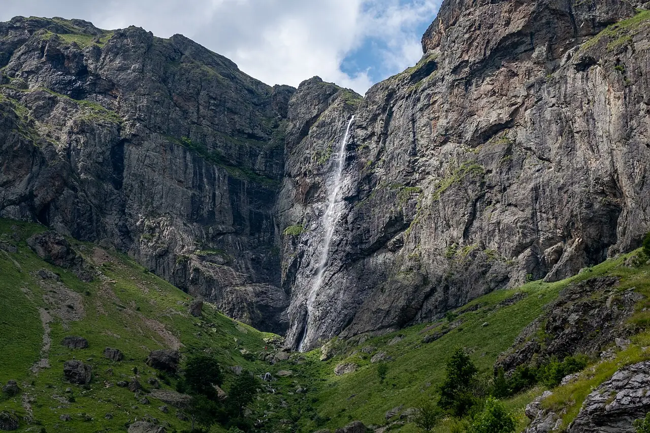
Raysko Praskalo falls about 124 metres off the Botev massif, which makes it the highest waterfall on the peninsula. It is fed by snowmelt, so it is spectacular in June and can be a trickle by late August — the timing matters more here than at most places.

The walk starts at Kalofer and climbs through the Central Balkan National Park to Rai hut, then on past the falls and up to Botev at 2,376 metres. It is a long day with a serious climb at the end, and the summit carries a weather station and a microclimate to match: the wind on Botev is frequently the strongest recorded in the country.

This is also the historical heart of Bulgaria. The peak is named for Hristo Botev, the poet and revolutionary killed nearby in 1876, and Kalofer below is his birthplace. Walking up here on the second of June, when the whole country stops for the sirens at noon, is a different experience from walking up here on any other day.

Local tip

Come in June if you want the waterfall at full flow. By September it can be almost dry.

Show on map